Problem
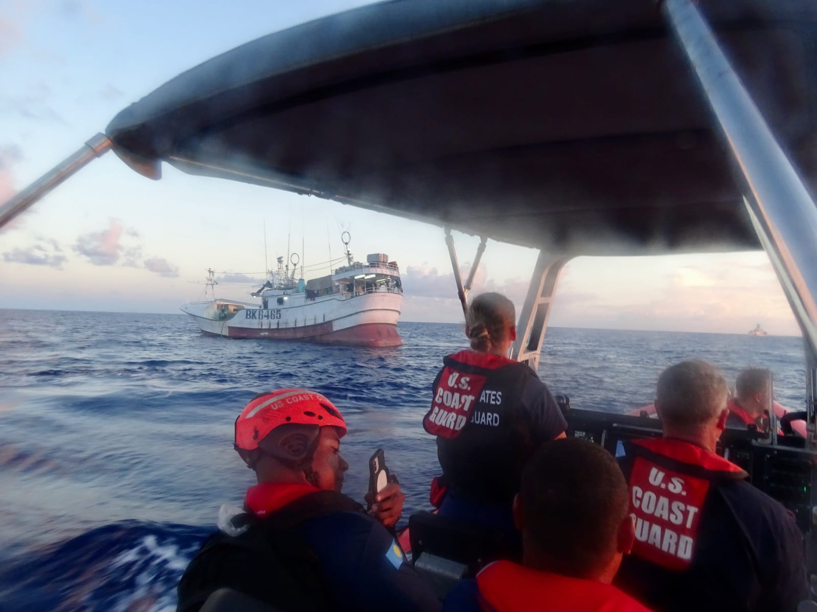
Gabon has Africa’s largest network of marine protected areas. Its vessel monitoring system, a tracker carried by the national fleet, goes blind when a crew switches it off.
According to a case study on Skylight’s website, that is how the vessel GUO JI 838 entered a restricted marine protected area: monitoring system off, but still visible through another signal. Skylight alerted analysts at Gabon’s national parks agency, which issued a warning and sent a patrol. The case study is undated and does not say how the patrol ended.
Most of the world’s fishing fleet is harder to see than that boat. A 2024 study in the journal Nature, which mapped industrial vessels with satellite images and AI, found that 72 to 76 percent of industrial fishing vessels are not publicly tracked. Much of that fishing happens around South Asia, Southeast Asia and Africa (data from 2017 to 2021).
Illegal, unreported and unregulated fishing harms fish stocks and the coastal communities that rely on them. Skylight says it focuses on states with few resources for this work.
AI solution
Most large ships broadcast their position through the automatic identification system (AIS), a radio signal meant to prevent collisions. Skylight says it reads more than 100 million of these messages a day.
Because AIS only shows boats that choose to be seen, Skylight also scans satellite images: radar that sees through clouds, ordinary photos from space, and night-time pictures of boat lights. Its AI models pick out vessels in those images, including ones with their tracking switched off. Skylight runs on OlmoEarth, Ai2’s family of foundation models for Earth observation: general-purpose AI models for satellite data that can be adapted to many tasks.
The software flags “events” for a person to check, such as a boat fishing, a vessel entering a protected area, or a ship meeting a vessel that is not broadcasting its position, which can mean catch is being moved between boats out of sight. Skylight is free, needs no special hardware, and says its technology is open source.
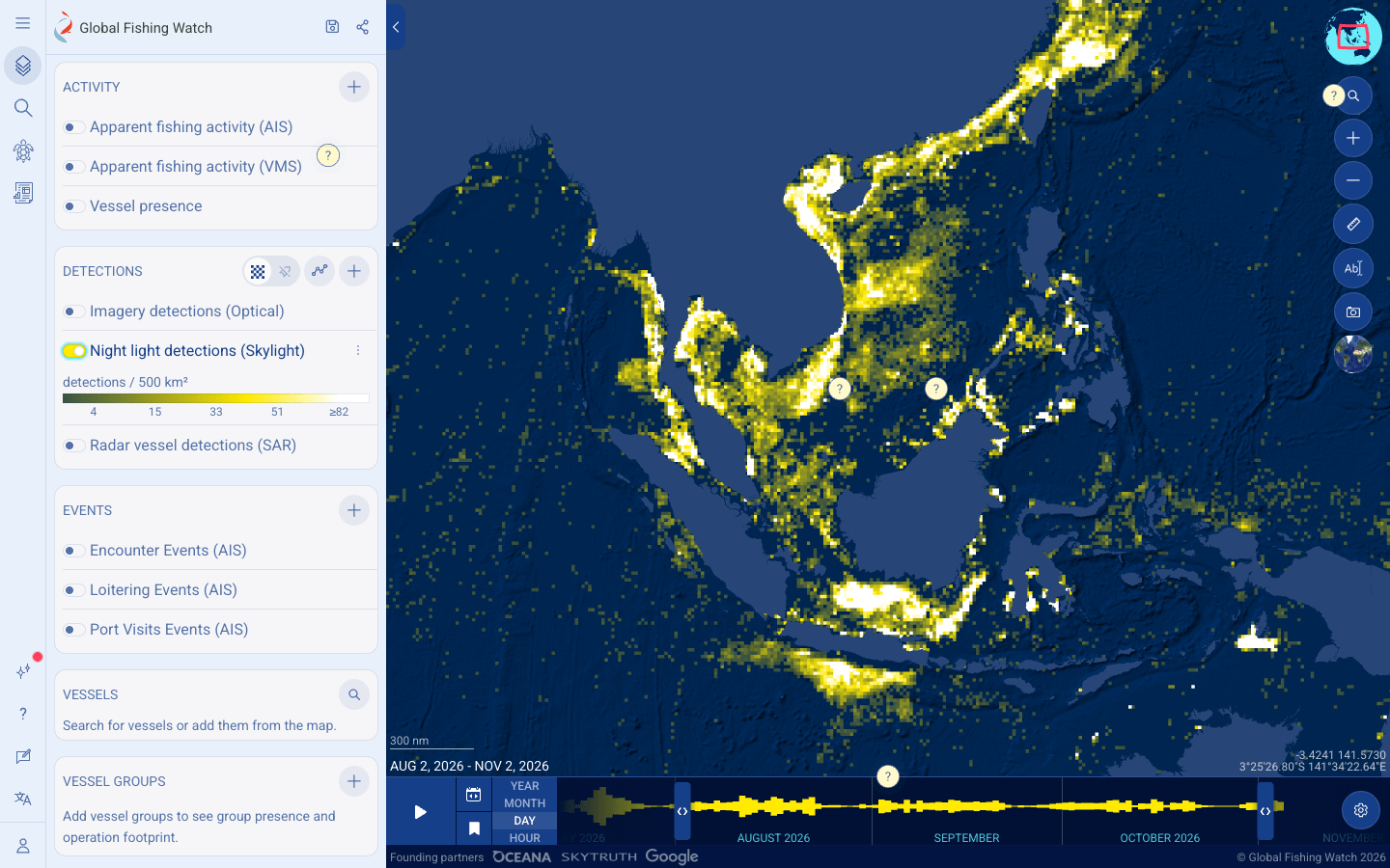
Global Fishing Watch, founded by Oceana, SkyTruth and Google and public since 2016, runs a free map of where fishing appears to be happening worldwide. Since March 31, 2026, the map has carried Skylight’s night-light detections, a daily worldwide layer at 750-meter detail. The model filters out lightning, gas flares and moonlit clouds, and users can show only lights that match no boat broadcasting AIS, a quick way to look for “dark” vessels.
What the partnership adds
The September announcement, made at Climate Week NYC 2026, describes plans. The two groups say they will:
- build new computer vision models that find vessels in satellite images in real time;
- give Global Fishing Watch access to OlmoEarth to label data and train its own models;
- feed Skylight’s real-time detections into Marine Manager, Global Fishing Watch’s portal for governments and protected-area managers;
- co-develop AI agents based on “Shippy,” Skylight’s existing assistant.
Here an AI agent means a chat-style helper. An analyst could ask “What has this vessel been doing?” or “What is unusual around this protected area?” and get back vessels and events worth a closer look. Both groups say the AI supports human judgment and does not replace it.
Impact
The figures for today’s tools come from the organizations themselves. Ai2 says Skylight is used in more than 70 countries. Skylight’s website says it tracks 290,000 vessels a week and surveys every exclusive economic zone (the waters a country controls up to 200 nautical miles from its coast) each month. None of these figures is dated or audited.
Ai2 and the International Union for Conservation of Nature (IUCN) signed an agreement that gives countries that ratified the High Seas Treaty free use of Skylight.
On October 21, 2026, Global Fishing Watch replaced its fishing detection and vessel classification models with new ones trained on more than 1,000 expert-checked examples, its largest AI upgrade since 2016. It says some fishing estimates fell because the models make fewer false alarms, not because there is less fishing.
The partnership itself has no results yet: no numbers, users or enforcement cases for the joint models, the AI agents or the Marine Manager link.
The new Global Fishing Watch models only help with vessels that broadcast their position, and the organization advises using its data alongside official registries and local knowledge. A satellite detection can show where a silent boat is, but someone still has to work out what it is doing.
People
Namrata Kolla leads Skylight at Ai2. She has more than ten years of experience in conservation, and earlier worked as a data scientist for the Mayor of Seattle. Ai2 is a nonprofit founded by the late Microsoft co-founder Paul G. Allen, and Skylight earns no revenue.
“Our goal isn’t AI for AI’s sake,” Kolla said in the announcement. “Our focus is on using technology to make the ocean more visible and give decision-makers the critical information they need to ultimately enable better decisions and drive impact.” She added that maritime partners want AI “where they own their own data, leverage open models, and decide what is the ‘right’ answer”.
Tony Long is CEO of Global Fishing Watch, which aims to map all human activity at sea by 2030. The technology’s “real value lies in its ability to get timely and actionable insights to those who can drive beneficial impact,” he said in the announcement.
Analysts, park staff and patrol crews act on the alerts, like the team at Gabon’s national parks agency, and Skylight’s website shows a member of Nigeria’s navy being trained on the platform and a Fiji Navy member being shown new features. Minna Epps of IUCN has said that nations that could never afford conventional monitoring can now watch their marine protected areas.
Why it matters
Coastal families depend on fish, and it is hard to protect an ocean where most industrial boats go unseen. Free satellite tools are already helping small agencies watch their waters, in more than 70 countries by Ai2’s count. The new AI assistants are still a plan, and both nonprofits say people will decide what the alerts mean.
What we could not confirm (7)
- Any results from the new partnership. As of November 5, 2026, the joint models, AI agents and Marine Manager integration are plans with no published outcomes.
- What Skylight’s assistant “Shippy” can do in practice today. We found no public demo.
- Skylight’s user figures (more than 70 countries, 290,000 vessels a week) come from Ai2 and Skylight, are undated, and have not been checked independently.
- When the Gabon case happened and how the patrol ended. Skylight’s case study gives neither.
- Whether the planned agents will act without constant human attention. One news outlet (Tech Times) described them that way; the official announcement says AI supports, and does not replace, human judgment. We follow the announcement.
- Independent evidence that alerts from these tools lead to fines, arrests or less illegal fishing.
- How much money the partnership involves.
FAQs (5)
What is Skylight?
Skylight is free software from Ai2 (the Allen Institute for AI) that helps maritime authorities spot suspicious vessel behavior using ship position signals and satellite images. Ai2 says it is used in more than 70 countries.
What did Global Fishing Watch and Ai2 announce?
On September 23, 2026, they announced a partnership to build computer vision models and AI assistants together, give Global Fishing Watch access to Ai2's OlmoEarth models, and add Skylight's real-time detections to Global Fishing Watch's Marine Manager portal. No results have been published yet.
Can satellites find fishing boats that turn off their trackers?
Partly. Radar and night-light satellite images can show vessels that are not broadcasting their position, and Skylight's night-light detections have been on the Global Fishing Watch map since March 2026. People still need to check what a detected boat is doing.
How many fishing vessels are not publicly tracked?
A 2024 study in Nature found that 72 to 76 percent of the world's industrial fishing vessels are not publicly tracked, based on data from 2017 to 2021.
Do the AI agents decide who is fishing illegally?
No. According to both organizations, the agents will search data and suggest vessels and events to investigate, and human analysts make the decisions.
Sources (8)
Global Fishing Watch, Skylight VIIRS detections added, platform update, 2026-03-31
Skylight, Platform page (undated, read 2026-11-05)
Skylight, About page (read 2026-11-05)
Ai2, OlmoEarth's impact: Oceans (undated, read 2026-11-05)
Fact-checked against sources on November 5, 2026. Spot an error? Tell us.
This story supports